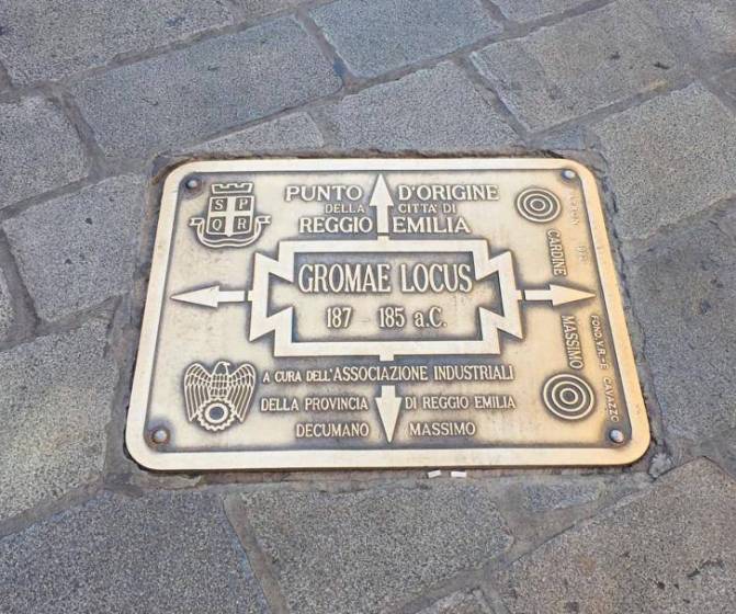
On the Via Emilia, at the height where it crosses Via Roma, there is a plaque on the ground representing what was once the intersection of the Cardo and the Decumanus.
As in other Emilian cities, the Romans used to decree a point of origin within the occupied territory.
At this point, they fixed the two main road axes, Cardo and Decumanus, which would have decreed the division of the nascent city into districts.
The Cardo is the axis that goes from north to south, the Decumanus instead crosses the urban centre from east to west.
The plaque is placed on the pavement of Via Emilia, more or less at the level of Via Roma, to remind the citizens of the physical point of the beginning of the city (between 187 and 185 BC).
