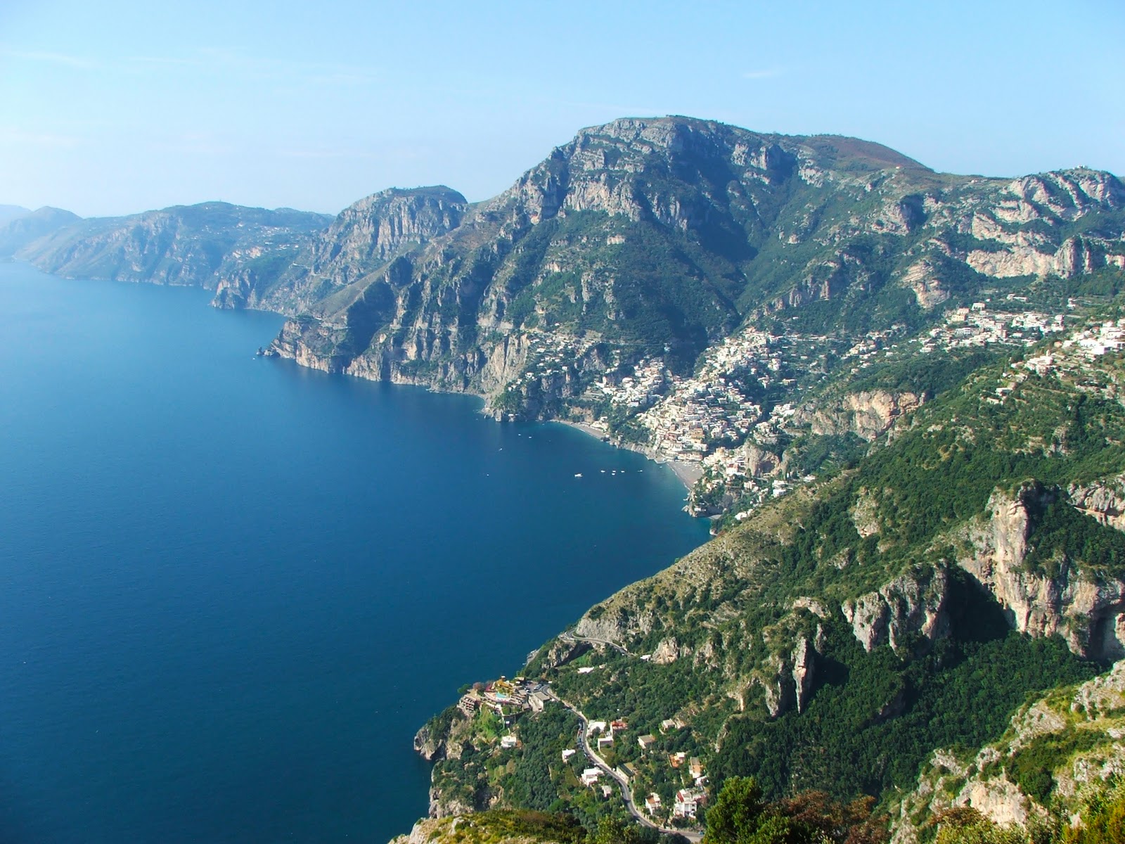
The name of this route announces wonders, and the places traversed deliver on the promise. This walk takes place on a route that has been used for centuries by local people as a communication route. Before the opening of the carriage road between Agerola and Amalfi, paths and mule tracks were the only means of communication between the towns in these rugged mountains. The paths were beaten by peasants with their mules loaded with farm equipment and produce, but also by laborers intent on transporting building materials and so on. The Path of the Gods is probably the best known of the park’s trails, and its fame is absolutely deserved, as historical-architectural and naturalistic values, from geology to botany, are contained in a single itinerary.
Starting from Bomerano, one reaches Positano by crossing an incredible succession of walls and caves, cultivated terraces and ruins of ancient dwellings, wooded stretches and belvederes suspended over the coast. The encounters one has on this route are almost exclusively with other hikers, mostly foreigners. But you still happen to cross paths with the farmer who, with his mule loaded with fruit or tools, returns or goes to his tiny vegetable garden laboriously wrested from the slope of the hillside. The trail is very wide and well-maintained, always well marked with markers and signs, and the very low elevation gain means that anyone can fully enjoy one of the most beautiful places in the park. Only the final stretch, the descent from Nocelle to Positano, requires a modicum of caution, as the 1,700 steps must be approached calmly so as not to then have muscle discomfort or blisters.
Description of the trail
The trail starts from Piazza Paolo Capasso in Bomerano, a small hamlet ofSentiero degli Dei Agerola. Those arriving by car can park freely about 100 meters beyond the main square. A sign near the church of San Matteo provides historical-cultural directions on the trail and clearly indicates the direction to follow. From here on, the evidence of the trail and the presence of markers make it impossible to go wrong. In addition, there are mile markers marking the distance at 100-meter intervals.
A downhill lane leads in a few minutes to a wooden bridge; a few uphill steps follow and then a short paved section at the base of a wall. The view to the left suddenly becomes wide, with views of the sea and cultivated terraces that are clinging to different heights. A few more hundred meters downhill, protected by metal railings, lead to Grotta Biscotto (588 m), where there is a spring of drinking water. The cave is the relict of a karst cavity partially filled with volcanic deposits, in which evidence (faults) of more recent tectonic movements can be recognized. Here the path joins the trail (CAI path no. 27) coming from Furore (beginning at km 10 of state road no. 366). Continue in the direction of Positano/Nocelle and, after a short flat section, pass the base of a limestone spire at the top of which a plaque commemorates Ettore Padano, a CAI mountaineer from Naples who initiated many young people into climbing.
A few steps lead up to a fork in the road: a high variant can be followed to the right, but our itinerary follows the Positano/Praiano/Nocelle sign on the left. At Colle la Serra (578 m) further steps, this time downhill, lead to another fork: on the left begins path no. 19, which in about 1 hour and 30 minutes leads to Vettica Maggiore and Praiano; on the right continues path no. 27 to Nocelle and Positano. A few houses stand here, occasionally inhabited, but reachable only on foot or by mule. The view of Vettica Maggiore is stupendous.
At kilometer 1300 you take an uphill branch off to the right. The path becomes very exposed for over 1 km and it is advisable to be careful, especially if you are in the company of children. In the locality of Cannati some small tables lend themselves to a scenic stop. After a section at the base of a high wall where small caves open up, the trail climbs among the rocks, but obvious red arrows make the path easier. A little further on it rejoins the high variant encountered just before Colle la Serra.
After milepost 2400 the trail continues through groves of holm oak that dispense certainly welcome shade. A couple of very incised valleys are passed, where wooden parapets protect the trail, but leave the more exposed sections unprotected.
At kilometer 4500 you reach the hamlet of Nocelle, where you can stop at a couple of B&Bs and rest in the shade of a small brick niche, complete with a drinking fountain.
Here the trail joins trail No. 31: one can continue right to Montepertuso and then (trail No. 31A) reach Positano; or left, descending the first of the 1,700 steps that in about 1 hour and 420 meters of elevation gain lead to Arienzo, on the state highway 163 Amalfitana. Here you can continue on foot (10 minutes) to Positano or take a Sita bus back to Bomerano, via Amalfi.
Notes
Another itinerary called "Sentiero degli Dei" is CAI path no. 02, a variant of the Alta Via dei Lattari (no. 00): from Crocella (1,002 m), passing Capo Muro (1,072 m), it joins the Alta Via at the Forestry Barracks (767 m). In some cases this is called the High Trail, while the one described above is known as the Low Trail. It was felt to suggest the low trail as it is more spectacular and accessible to all.
Although the route is always easy and without possibility of error, in some places it is exposed and unprotected: it is strongly recommended to watch out for any accompanying children, possibly holding their hands in the most dangerous sections. The spring (Grotta Biscotto) is at the beginning of the trail, so it is advisable to equip yourself with a capacious water bottle, especially on hot days. The fountain at Nocelle is providential for refreshment before tackling the long descent.
Practical information
Difficulty: E (easy, with exposed sections).
Elevation gain: 638 meters total (about 220 m from Bomerano to Nocelle, about 420 m from Nocelle to Positano).
Walking time: 4 hours.
Equipment required: hiking shoes, cap and sunscreen, day pack, water.
How to get there.
By car: from State Road No. 163 Amalfitana reach Vettica Minore and from here take the road that, uphill in hairpin bends, leads to Bomerano (11 km); from the north side reach Castellammare di Stabia and from here follow the signs for Gragnano/Agerola (about 15 km).
By public transport: frequent Sita buses reach Agerola/Bomerano from Amalfi and Castellammare di Stabia or Naples.
