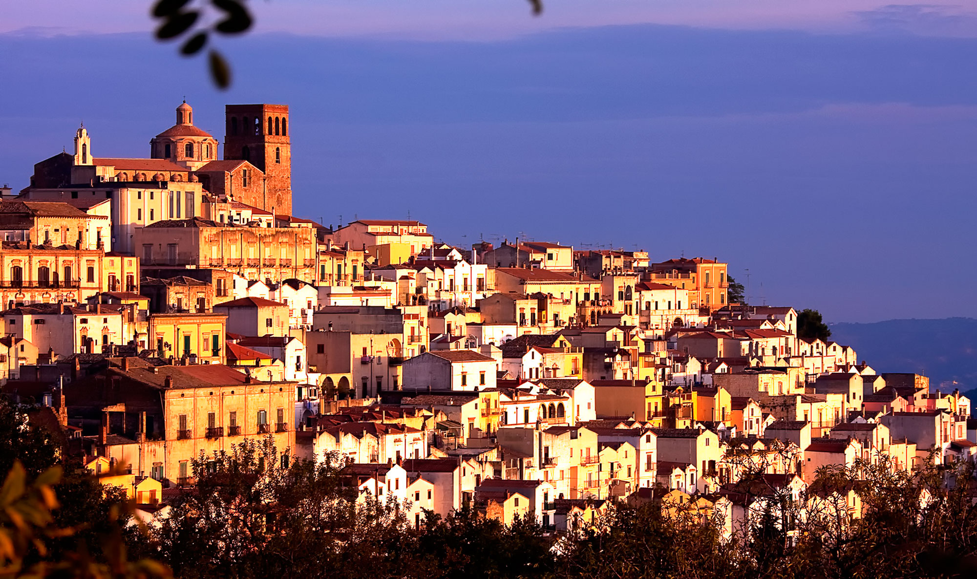
The town lies on a hillside at 482 m above sea level in Val Basento on the western bank of the Basento River of the same name in the north-central part of the province. The municipal house is located at an altitude of 497 m a.s.l. although in the suburbs the altitude is also at peaks of 550-580 m a.s.l. Because of its altitude Ferrandina is part of the mid-Materanian hills and The territory of the municipality has an extension of 215.55 km2, the fourth largest in all of Basilicata.
Ferrandina’s roots go back to Magna Graecia, around 1000 BC. Its name was Troilia, while its acropolis-fortress was called Obelanon (Uggiano). Troilia was built to remember and honor the destroyed city of Asia Minor, Troy. During Roman times Troilia and Obelanon were important centers of Hellenic culture and increasingly gained luster in Byzantine times. With the fall of Greek rule, Lombards and Normans took over the town.
The present town originated from the ruins of the ancient center of Uggiano, destroyed by a terrible earthquake in 1456.
It was founded in 1490 by Frederick of Aragon, who named the town after his father, King Ferrante or Ferrantino, and took in all the escapees from Uggiano.
In medieval times several feudal families took turns in ruling the town, the last of which was that of the Garcia of Toledo.
The town has interesting architectural features.
"The historic center represents a typical example of Renaissance town planning,based on perspective criteria and modular regularization of buildings, and is characterized by a remarkable architectural homogeneity due to the integrity of the terraced urban layout, organized by straight and parallel streets, except for
of the few unevenness of the aristocratic palaces and the four monastic complexes that have sprung up since the 16th century.
Famous for the cultivation of olives and the excellent oil produced from them, Ferrandina is now among the few industrial towns in Lucania, thanks in part to the methane that is extracted in its territory.
