In 2010, for almost two months, the ashes of an Icelandic volcano blocked over 100,000 commercial flights in Europe, leaving millions of passengers stranded. That volcano was Eyjafjallajökull, an unpronounceable name for non-Icelanders, but now become a symbol of the indomitable power of nature. What few know is that this geological colossus, standing 1,651 meters above sea level, is visitable: specialized guides accompany travelers to the edges of its crater covered by a permanent glacier, in one of the most dramatic and authentic landscapes of southern Iceland.
The starting area for most excursions is the valley of Þórsmörk, a protected area nestled between glaciers and glacial rivers, accessible only by off-road vehicles due to the fords that cross the waterways. The journey itself is an experience: modified buses with huge wheels slowly advance through the icy water, while the mountains close in around. Here, civilization seems very far away, and the volcano dominates the horizon with its white cap contrasting with the black of the solidified lava.
The geological history and the eruption of 2010

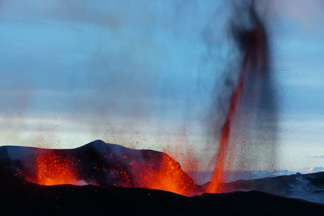
The Eyjafjallajökull is not an isolated volcano: it is part of a complex volcanic system in the southern region of Iceland, one of the tectonically most active areas on the planet, where the North American and Eurasian plates separate by about 2.5 centimeters per year. The volcano has a long history of eruptions, but that of April 14, 2010 is etched in the global collective memory. The subglacial eruption generated columns of volcanic ash that reached 9 kilometers in height, dispersing across the entire European continent and causing airspace closures for weeks.
Walking on its slopes, one can still observe the signs of that event: fields of black, rough lava, deposits of gray tephra, and the twisted shapes of rapidly cooled volcanic rock. The summit glacier, which covers the crater with a thick layer of ice several meters deep, is clearly visible on clear days even from the coast, tens of kilometers away. Watching it live, knowing what it is capable of, has an almost reverential effect.

How a guided tour takes place
Guided tours at Eyjafjallajökull typically start from Þórsmörk or the farm Þorvaldseyri, at the foot of the volcano on the southern side. The latter also hosts a small visitor center where videos of the 2010 eruption are shown: a powerful introduction before venturing onto the terrain. The most common tours last between 6 and 10 hours and involve significant elevation gain, with sections on ice that require crampons and an ice axe provided by the guides.

Local companies like Midgard Adventure and other operators based in Hvolsvöllur offer regular tours during the summer season. Prices typically range around 150-250 euros per person for complete tours with equipment included. These are not walks for everyone: good physical fitness is required and mountain experience is recommended. However, the guides are prepared to adjust the pace to the group and provide detailed geological explanations along the way.
What can be seen at the top: the crater and the glacier

Getting close to the crater of Eyjafjallajökull is a visually intense experience. The rim of the crater is wrapped in glacier, and from there, on clear days, a panorama opens up stretching to the Atlantic Ocean to the south and towards the massif of Mýrdalsjökull to the east, beneath which lies the volcano Katla. The contrast between the white of the ice, the black of the lava, and the green of the underlying valleys is one of those landscapes that is hard to forget.
On the glacier, the guides show the crevasses, explain how the ice slowly moves downward, and how the interaction between volcanic heat and ice generated the steam and ash explosions of 2010. Walking on an active glacier above an active volcano is a feeling that puts the timescale of geology into perspective compared to that of humans.
Practical tips for the visit
The best season for hiking on Eyjafjallajökull is from June to September, when the weather conditions are more stable and the trails are accessible. Icelandic weather remains unpredictable even in summer: it is essential to bring layered waterproof clothing, even if the day starts sunny. Many hikes are canceled or modified due to bad weather, so it is advisable to book flexibly and check the local forecasts on vedur.is, the official website of the Icelandic meteorological service.
To reach Þórsmörk without an organized tour, a 4x4 vehicle with certified fording is necessary: regular cars cannot cross glacial rivers and attempts often end with the vehicle being recovered. Those without an adequate off-road vehicle can take the Reykjavik Excursions buses that depart from Reykjavik and reach the area. Booking excursions at least a few days in advance during the high season is strongly recommended.